
1.10.2013 | Frederik Ramm
(For an English version, see other post.)
Obwohl die Geofabrik in der OpenStreetMap-Szene weithin bekannt ist, werden wir selbst von Insidern oft gefragt: Was macht ihr eigentlich außer all den praktischen Sachen für die Community – was ist Euer Geschäftsmodell?
Wir sagen dann gern: Die Geofabrik ist im Grunde ein Handwerksbetrieb. Sowas wie eine Schreinerei – der Kunde kommt und sagt “bauen Sie mir einen Schrank”, und dann unterhält man sich über die Details, bietet ihm was an, und wenn das für den Kunden gut klingt, dann bauen wir ihm den Schrank. Natürlich trägt die Analogie nur begrenzt – für einige Kunden können wir möglicherweise einen Standard-Schrank bauen, was die Sache vereinfacht. Anderen empfehlen wir vielleicht nach einem längeren Gespräch, dass sie lieber einen Nachttisch kaufen sollen, oder dass sie ihre Sachen doch auch in einem von unseren Schränken aufbewahren können. Oder wir geben ihnen eine Bauanleitung für einen Schrank. Was uns aber an der Analogie gut gefällt, ist das Handfeste: Wir sind nicht “in der Cloud”, sondern ein solider Ingenieurbetrieb, und wir beherrschen unser Handwerk.
Seit ihrer Gründung 2007 hat die Geofabrik eine ganze Reihe verschiedener Projekte durchgeführt und Produkte oder Dienstleistungen verkauft, und wir haben jetzt endlich eine Auswahl davon auf unserer Webseite zusammengestellt, damit man leichter sehen kann, was wir eigentlich machen.
Echte Schränke sind übrigens keine dabei.
Wer sich für einen kleinen Einblick in das Tagesgeschäft der Geofabrik interessiert, dem seien die (englischen) Folien zu Frederiks Talk “Open for Business” von der State of the Map US empfohlen.
22.06.2013 | Frederik Ramm
We’ve overhauled the download server (download.geofabrik.de) a couple months ago but never really wrote anything on our blog so, let me quickly mention that for a few months now we do not only have a nicer user interface with overview maps and MD5 sums, but we also have selected older versions (usually, data from the past couple of days plus the 1st of each month for the current year) for every extract, as well as incremental updates (diff files). These updates allow you, for example, keep a country extract current by downloading only a fraction of the full file every day, or update an osm2pgsql database that you run with Europe only.
Last weekend we added free daily shape files for Canada’s provinces/territories, and from today we’ll also be serving free daily shape files for all US states. (Larger shape files, e.g. for all of Canada, all of the US, other continents, or the whole world, as well as shape files with more detail or tailored to a specific use case, are made to order for a fee – see http://www.geofabrik.de/data/shapefiles.html).
Would you like to see me explaining the download server (and the technology behind it) in a 20 minute video? Then watch my talk from the SOTM-US conference on Vimeo! The slides are available as well.
4.04.2013 | Frederik Ramm
The OSM Inspector’s “routing” view has always been the “odd one out” among the OSMI views. It higlights potential problems for routing, and was initially sponsored by Skobbler. At first it was available only for the EU; later we rolled it out world-wide but lacked the resources to actually update the world-wide view regularly, leaving us with a daily updated “Europe” view and a less frequently updated “non-Europe” view. We were hoping to attract someone to sponsor that section of OSMI but since nobody was forthcoming we’ve now put it on a more solid footing (read: better hardware) ourselves. The routing view should now update regularly for the whole world, and is also available as one single layer.
(If you should have bookmarked the old “routing-non-eu” view, drop the “non-eu” to use the unified routing view.)
This is also a good opportunity to thank OSM’s routing experts Pascal Neis (inventor of the original openrouteservice.org, and developer of the “unconnected” and “duplicate” layers in OSMI’s routing view) and Dennis Luxen (the man behind OSRM, and supplier of the “islands” layer in OSMI’s routing view).
The new hardware will allow us to add a couple more improvements to OSMI in the coming months.
24.02.2013 | Christine Karch
Die Geofabrik ist umgezogen. Die neuen Räume haben wir schon im Januar angemietet, aber diverse Renovierungsarbeiten haben uns dann doch noch einen Monat aufgehalten.
Eine kleine Abstellkammer haben wir durch den Einbau einer Klimaanlage in einen Serverraum umfunktioniert. Neben den Servern, die für unsere täglichen Updates der OpenStreetMap-Daten verantwortlich, findet hier auch unser wichtiger Grossformat-Drucker Platz.
Im grossen Büro sah es zwischenzeitlich recht chaotisch aus, weil wir hier alles reingestopft haben, was in den anderen Räumen bei den Umbauarbeiten gestört hat. In einem seltenen Moment bot sich aber auch eine Gelegenheit, den Raum einmal leer zu fotografieren.
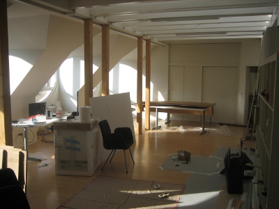
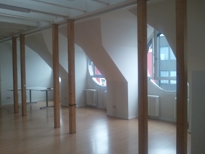
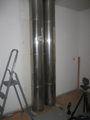
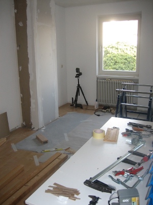
In der Küche haben wir alles herausgerissen. Die Verkleidung der Außenwand und das Küchenmobiliar haben wir neu gemacht.
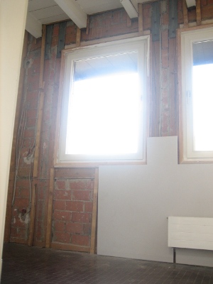
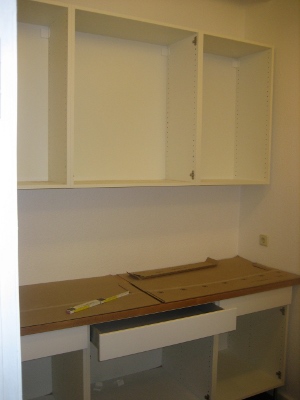
Das, was hier noch eine Werkstatt ist, wird irgendwann mal ein Meetingraum.
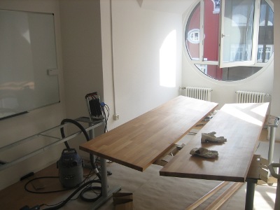
Rechtzeitig zum Hack-Weekend dieses Wochenende musste alles fertig sein – und es hat auch gerade so alles geklappt.
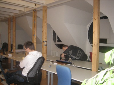
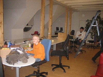
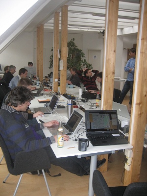
Plangemäß konnte das Februar-Hackweekend stattfinden. Die neuen Räumlichkeiten wurden standesgemäß eingeweiht.
21.11.2012 | Frederik Ramm
We’re making two new map styles publicly available on our map web site, map.geofabrik.de – one is the German style that we mentioned a while ago, and the other is our “topo style”:
The topo style is a relatively simple style that blends OSM data with hillshading and contour lines generated from enhanced SRTM data that we have licensed from CIAT. This style is preferred by clients who want to overlay other information (like hiking trails or cycle routes) on the map and have little use for a colourful style like the standard Mapnik map. On the topo style, all roads are grey and we only use two different shades of green for forests and meadows; buildings are added at higher zoom levels.
The topo style is available world-wide but due to the limitations of SRTM data, hillshading and contours are only visible between 60°S and 60°N.
Our map styles are freely viewable on map.geofabrik.de, where tiles come under a CC-BY-SA license. If you want to use these maps in your own application, please contact us or see our web page on Tile Servers.