30.03.2023 | Frederik Ramm
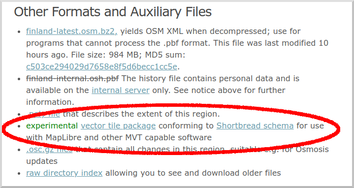
We’ve started making vector tile packages available on our download server at download.geofabrik.de. At the moment you’ll find a .tar.gz file with vector tiles typically on the same level where you’d also find shape files — i.e. we don’t give you a package for all of Europe, but for individual European countries, and we don’t have a package for all of the US, but for individual states and so on.

These vector tiles use our Shortbread schema, and we create them with the excellent open source Tilemaker software. For suitable MapLibre vector styles, have a look at the VersaTiles repository.
This is supposed to be an experiment and we don’t yet make any promises about the structure and update frequency of this offer. We’re happy to hear your ideas though. At present, the .tar.gz files simply contain all vector tiles for the region as simple files (which are themselves .gz compressed so you might have to instruct your web server to add the appropriate encoding headers).
Like everything else on our download server, these tiles are made from OpenStreetMap data and come under Open Database License 1.0 with an OpenStreetMap attribution requirement.