13.11.2024 | Frederik Ramm
We frequently receive requests from researchers about “old” OpenStreetMap data. In one instance we’ve been asked whether we could provide data for a city road grid – for the year 1980! So let’s take a minute to explain what is possible and what isn’t.
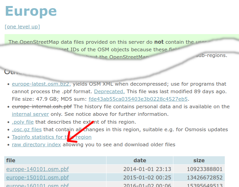
In general, you can download older data files – for the 1st of January of each year – from our download server. Just click on the “raw directory index” link and you’re presented with a list of available files – either .osm.pbf or shape files. Sometimes when we’ve split up a country in smaller regions at some point, you might only find more recent files for the small regions, but older files for the whole country.

OpenStreetMap keeps a full history of everything, so it is possible to extract even more fine-grained snapshots – say for the 1st of each month since 2014! This will require the “osmium” utility (with its –time-filter option), as well as a “full history” file. Such files are available (for the whole world) from planet.openstreetmap.org, but also for individual continents or countries from our project-internal download server. (Because these files contain metadata that may be personal data, access is only allowed with an OSM login.)
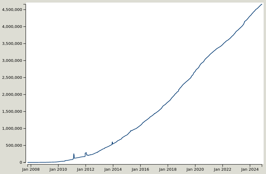
There are a number of caveats that apply to working with historic OSM data though. First and foremost: An OSM data set of time X tells you what OSM knew about the world at that time – and not what the world was like at that time. If a building has been there for 100 years but was only added to OSM in 2020, then the 2018 data set will not contain that building. You can get an idea of what to expect in an old OSM data set from the “chronology” tab of the taginfo service (globally at taginfo.openstreetmap.org, or for individual regions at taginfo.geofabrik.de). Here’s a graph of the “building” tag for Spain:

As you can see, OSM currently has about 4.5 million building objects in Spain, and in 2014 we had about 450,000. Does that mean that 90% of Spain’s buildings have been erected in the last 10 years? No – it only means that OSM was much smaller in 2014 than it is today!
Because OpenStreetMap was invented in 2004, obviously any data export for any time before 2004 will be completely empty. In the early years we also had a few incompatible data model changes, and the license change in 2012 meant that some data had to be removed again. So, going back further than the license change will really give you very patchy results, and is not recommended for most use cases.
Another thing to consider is that in some areas the mapping methods have changed, and something that was mapped as X in 2014 might today be Y. Depending on what research you are doing, it might be necessary to adapt your filters to that.
If you would like to enlist our help in extracting historic information from OpenStreetMap, we’re happy to make you an offer.