
1.10.2013 | Frederik Ramm
(For an English version, see other post.)
Obwohl die Geofabrik in der OpenStreetMap-Szene weithin bekannt ist, werden wir selbst von Insidern oft gefragt: Was macht ihr eigentlich außer all den praktischen Sachen für die Community – was ist Euer Geschäftsmodell?
Wir sagen dann gern: Die Geofabrik ist im Grunde ein Handwerksbetrieb. Sowas wie eine Schreinerei – der Kunde kommt und sagt “bauen Sie mir einen Schrank”, und dann unterhält man sich über die Details, bietet ihm was an, und wenn das für den Kunden gut klingt, dann bauen wir ihm den Schrank. Natürlich trägt die Analogie nur begrenzt – für einige Kunden können wir möglicherweise einen Standard-Schrank bauen, was die Sache vereinfacht. Anderen empfehlen wir vielleicht nach einem längeren Gespräch, dass sie lieber einen Nachttisch kaufen sollen, oder dass sie ihre Sachen doch auch in einem von unseren Schränken aufbewahren können. Oder wir geben ihnen eine Bauanleitung für einen Schrank. Was uns aber an der Analogie gut gefällt, ist das Handfeste: Wir sind nicht “in der Cloud”, sondern ein solider Ingenieurbetrieb, und wir beherrschen unser Handwerk.
Seit ihrer Gründung 2007 hat die Geofabrik eine ganze Reihe verschiedener Projekte durchgeführt und Produkte oder Dienstleistungen verkauft, und wir haben jetzt endlich eine Auswahl davon auf unserer Webseite zusammengestellt, damit man leichter sehen kann, was wir eigentlich machen.
Echte Schränke sind übrigens keine dabei.
Wer sich für einen kleinen Einblick in das Tagesgeschäft der Geofabrik interessiert, dem seien die (englischen) Folien zu Frederiks Talk “Open for Business” von der State of the Map US empfohlen.
22.06.2013 | Frederik Ramm
We’ve overhauled the download server (download.geofabrik.de) a couple months ago but never really wrote anything on our blog so, let me quickly mention that for a few months now we do not only have a nicer user interface with overview maps and MD5 sums, but we also have selected older versions (usually, data from the past couple of days plus the 1st of each month for the current year) for every extract, as well as incremental updates (diff files). These updates allow you, for example, keep a country extract current by downloading only a fraction of the full file every day, or update an osm2pgsql database that you run with Europe only.
Last weekend we added free daily shape files for Canada’s provinces/territories, and from today we’ll also be serving free daily shape files for all US states. (Larger shape files, e.g. for all of Canada, all of the US, other continents, or the whole world, as well as shape files with more detail or tailored to a specific use case, are made to order for a fee – see http://www.geofabrik.de/data/shapefiles.html).
Would you like to see me explaining the download server (and the technology behind it) in a 20 minute video? Then watch my talk from the SOTM-US conference on Vimeo! The slides are available as well.
4.04.2013 | Frederik Ramm
The OSM Inspector’s “routing” view has always been the “odd one out” among the OSMI views. It higlights potential problems for routing, and was initially sponsored by Skobbler. At first it was available only for the EU; later we rolled it out world-wide but lacked the resources to actually update the world-wide view regularly, leaving us with a daily updated “Europe” view and a less frequently updated “non-Europe” view. We were hoping to attract someone to sponsor that section of OSMI but since nobody was forthcoming we’ve now put it on a more solid footing (read: better hardware) ourselves. The routing view should now update regularly for the whole world, and is also available as one single layer.
(If you should have bookmarked the old “routing-non-eu” view, drop the “non-eu” to use the unified routing view.)
This is also a good opportunity to thank OSM’s routing experts Pascal Neis (inventor of the original openrouteservice.org, and developer of the “unconnected” and “duplicate” layers in OSMI’s routing view) and Dennis Luxen (the man behind OSRM, and supplier of the “islands” layer in OSMI’s routing view).
The new hardware will allow us to add a couple more improvements to OSMI in the coming months.
24.02.2013 | Christine Karch
Die Geofabrik ist umgezogen. Die neuen Räume haben wir schon im Januar angemietet, aber diverse Renovierungsarbeiten haben uns dann doch noch einen Monat aufgehalten.
Eine kleine Abstellkammer haben wir durch den Einbau einer Klimaanlage in einen Serverraum umfunktioniert. Neben den Servern, die für unsere täglichen Updates der OpenStreetMap-Daten verantwortlich, findet hier auch unser wichtiger Grossformat-Drucker Platz.
Im grossen Büro sah es zwischenzeitlich recht chaotisch aus, weil wir hier alles reingestopft haben, was in den anderen Räumen bei den Umbauarbeiten gestört hat. In einem seltenen Moment bot sich aber auch eine Gelegenheit, den Raum einmal leer zu fotografieren.
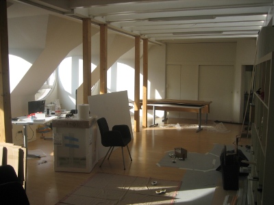
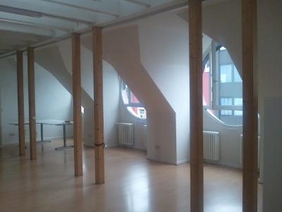
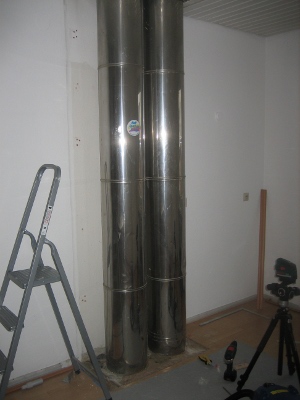
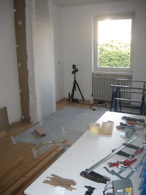
In der Küche haben wir alles herausgerissen. Die Verkleidung der Außenwand und das Küchenmobiliar haben wir neu gemacht.
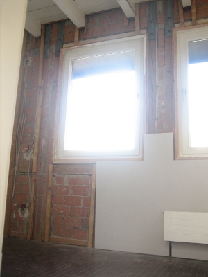
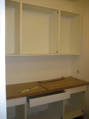
Das, was hier noch eine Werkstatt ist, wird irgendwann mal ein Meetingraum.
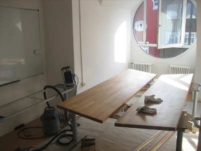
Rechtzeitig zum Hack-Weekend dieses Wochenende musste alles fertig sein – und es hat auch gerade so alles geklappt.
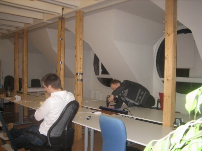
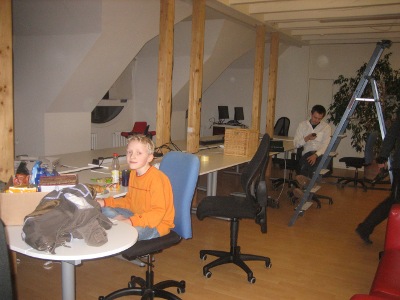
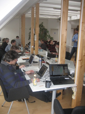
Plangemäß konnte das Februar-Hackweekend stattfinden. Die neuen Räumlichkeiten wurden standesgemäß eingeweiht.
21.11.2012 | Frederik Ramm
We’re making two new map styles publicly available on our map web site, map.geofabrik.de – one is the German style that we mentioned a while ago, and the other is our “topo style”:
The topo style is a relatively simple style that blends OSM data with hillshading and contour lines generated from enhanced SRTM data that we have licensed from CIAT. This style is preferred by clients who want to overlay other information (like hiking trails or cycle routes) on the map and have little use for a colourful style like the standard Mapnik map. On the topo style, all roads are grey and we only use two different shades of green for forests and meadows; buildings are added at higher zoom levels.
The topo style is available world-wide but due to the limitations of SRTM data, hillshading and contours are only visible between 60°S and 60°N.
Our map styles are freely viewable on map.geofabrik.de, where tiles come under a CC-BY-SA license. If you want to use these maps in your own application, please contact us or see our web page on Tile Servers.
12.09.2012 | Frederik Ramm
If we were a little slow in responding to inquiries during the past two weeks, that’s because the majority of Geofabrik staff – read: Christine and myself – were in Japan, combining participation in this year’s State of the Map conference with a little bit of tourism.
Japan is a very interesting country with lots of attractions, and around this time of the year rather warmer and more humid than our home climate. We had been preparing for the trip for quite a while, taking lessons in Japanese and reading a lot about Japan’s culture (and cuisine).
The conference took place on the campus of Tokyo University. The facilities were excellent; someone mentioned that Tokyo University is not just any university but a rather elite affair where they only take the brightest (or best-connected) students. There were lots of students helping with the organisation on the local team, and they all did that without compensation.
The conference bag and T-Shirt were beautifully designed, with Kanji characters on them that reference historic land surveying in Japan. To make sure we would return our empty food and drink containers, everyone received two specially minted “way” coins which had to be deposited whenever you fetched something to eat or drink, and were returned in exchange for your garbage.
Food at the conference was plentiful, with a large selection of different “Bento Boxes” to select from for lunch.
On Thursday evening there was a sponsored welcome party with a mixture of Italian and Japanese food, and on Friday we had a sponsored boat cruise with a multi-course dinner of various Japanese specialties like sashimi and tempura.
Talks at the conference covered a wide range of topics; a recurring theme was the use of OSM in disaster response and the humanitarian context, but we also heard about technology and OSM’s social fabric.
The one thing that brought tears to everyone’s eyes was the shooting of the group photo which involved looking at a high-flying unmanned aerial vehicle for extended periods of time 😉
We greatly enjoyed our time in Japan and at this impeccably well-organised conference. Thank you to everyone who helped!
29.06.2012 | Frederik Ramm
Some time in the future I’d like to have a giant button on my desk and every time I press it, a new tile server is ordered, bootstrapped, configured, and seamlessly added to our infrastructure. And if you read the glitzy announcements from various “cloud computing” providers you might think that this is actually not very far away.
However at Geofabrik we’re still doing things like our grandparents did, oh well, maybe not, but we do things the old-fashioned way: We select and order physical hardware, individual machines that have a rack number and a physical location, and we configure them and grill them and test them and run them ourselves. We don’t even have a setup script that “does everything” because if we set up another batch of tile servers in half a year’s time then technology will have progressed again and we’ll be using different hardware or software…
The tile servers we set up are generally of the dynamic kind like the one OSM operates – we have a lot of tiles pre-rendered but we can render any tile, in any style, in any location, on demand if required. If you add a telephone booth on a rock in the Atlantic to OSM and load the respective tile on zoom level 18 from Geofabrik a few minutes later, the telephone booth will be there. (Please don’t do that though. Only if you have verified that the telephone booth really exists.) That means that our servers usually need a lot of SSD storage to keep a copy of OSM’s database. For the current generation, we’re using fairly standard Hetzner servers but equipped with 3x120GB of SSD, just enough to store a full OSM planet for the next year or so.
Today we’ve phased out the previous generation of machines, and also updated to the new Mapnik2 rendering engine. Other than that, our tile servers are running the classic OSM rendering stack – PostgreSQL/PostGIS (with hstore extension for access to seldom-used tags), osm2pgsql, and the Tirex queue manager.
We’ve also updated our map styles to reflect the latest OSM Mapnik style and its German variant, which we have slightly adapted to add German names to local names where they are present in OSM:

We’ll contribute that change to the openstreetmap.de site as well if people want to use it. We’re also working on a couple of new tile styles that our clients can use. Mapnik2 should also allow us to offer nice high-resolution tiles for “retina” displays or even print use in the future.
If you already are a user of Geofabrik tiles then you shouldn’t notice anything, apart from perhaps a minor style difference here or there. If you’re thinking of using our tiles then read more on our web site.
5.03.2012 | Christine Karch
Langsam ist bei uns nach dem Hack-Weekend wieder der Alltag eingekehrt. Ein sehr angenehmes Treffen ganz unterschiedlicher Leute mit ganz unterschiedlichen Projekten. Die Teilnehmer kamen von Bonn bis München und sogar aus Zürich zu uns nach Karlsruhe. Und auch die Karlsruher Community war zahlreich vertreten.


Es wurde viel gefachsimpelt und über Dinge geredet, die man endlich mal in Angriff nehmen sollte (und ein paar davon wurden auch tatsächlich erledigt oder zumindest angefangen): Frederik hat einen neuen Relationen-Layer für die Lizenzwechsel-Anzeige im OSM Inspector gebastelt; Jochen hat ein paar Bugs im Taginfo repariert. Ich habe dem Bigmap-Tool ein Frontend mit Karte verpasst, Sarah wurde mit Nominatim-Verbesserungswünschen überhäuft, und Sven hat am deutschen Mapnik-Stil gearbeitet. Andi und Stephan sah man ODbL-Statistiken ausrechnen, und Christoph musste zwischendurch immer mal wieder vor die Tür, um den neuesten Build der gesprochenen Fahranweisungen in seinem MoNav zu testen, und vieles vieles mehr.
Der große Tintenstrahldrucker der Geofabrik hat dafür gesorgt, dass der eine oder andere ein nettes Souvenir mit nach Hause nehmen konnte.

Am Samstag Abend wurde in grosser Runde im Büro zu Abend gegessen.
Wir hatten viel Spass dabei, und es soll nicht das letzte Wochenende dieser Art gewesen sein: Als Termin für das nächste Hack-Weekend in Karlsruhe hier bei der Geofabrik haben wir den 2. und 3. Juni 2012 anvisiert. Tragt Euch das schonmal in den Kalender ein – wir melden uns rechtzeitig hier und auf der Mailingliste mit einer genaueren Planung.
2.01.2012 | Christine Karch
Ich habe die Zeit zwischen den Jahren genutzt und Best of OpenStreetMap um einige interessante Beispiele erweitert.
Wer Best of OpenStreetMap noch nicht kennt: Es dokumentiert Meilensteine der OpenStreetMap Entwicklung. Wir zeigen herausragende Mapping-Beispiele, wenn sie eine historische Bedeutung haben oder wenn es sich ganz einfach um besonders interessante Stellen handelt.

Besonders erwähnenswert finde ich den Mapping Trip in die Regionen Beshood und Surkhrod in der
Provinz Nangarhar. Werft auch einen Blick auf diesen durchaus informativen und interessanten Blog aus Afghanistan: Jalalalaa Good!
Gleichzeitig möchte ich diese Gelegenheit nutzen, um mich vorzustellen: Seit August 2011 bin ich Mit-Geschäftsführer-/Inhaberin der Geofabrik. Ich komme aus dem Bereich der Web-Entwicklung und werde die Geofabrik insbesondere hier verstärken. Davor habe ich 9 Jahre bei plan b und 3 Jahre bei der 1&1 gearbeitet. Der OSM Community bin ich zum größten Teil noch unbekannt. Ich hoffe aber, dass sich das im Lauf der Zeit ändert, und werde meinen Teil zum Vorankommen des Projekts beitragen.
3.10.2011 | Frederik Ramm
Our OSM Inspector web site is an important part of many a mapper’s toolbox. It has a series of, daily updated, debug views on OSM data, highlighting potential problems from invalid multipolygons over strange tagging or faulty geometries to missing address data.
The OSM Inspector, or OSMI for short, has several thematic views (like “geometry”, “tagging”, “boundaries”), each of which again supports a number of individually selectable layers that highlight a specific kind of problem. OSMI displays its results over an OSM base map, and you can select individual bug reports and get more information about them, or even download a list of errors for further processing. There’s extensive documentation on the OpenStreetMap Wiki.
Worldwide Routing View
 While most views have always shown data computed in-house at Geofabrik, one of our views, the routing view, presents data that comes from an algorithm developed by Pascal Neis of OpenRouteService fame, and is sponsored by Skobbler. The routing view attempts to highlight obstacles to routing – mostly roads that are not connected when they should be, but also duplicate roads that may lead to strange routing results.
We do not have a sponsor for running this routing view world-wide on a daily basis right now, but we have run it once for the non-Europe part of the planet, and you can try it out here:
We’ll try to update this once a week or so. (The normal, sponsored routing view for Europe with daily updates is here.)
In all, OSMI has data collected by three different toolchains; one of them works globally and feeds e.g. the tagging, multipolygon, and general geometry debug views; the other two, including the routing view toolchain, currently do Europe only and would require re-writing or more hardware to cope with the whole planet.
Potlatch
It has always been possible to access OSMI views through WMS for use in other applications, especially as a background layer in editors. Users of the popular Potlatch editor were however unable to make use of this as Potlatch does not support WMS backgrounds. We have therefore configured OSMI to serve tiles as well. (We’re using the excellent open source MapProxy for that.)
If you are using Potlatch, you can now add any or all of the following background layers:
Those marked (*), and additionally all the public transport views offered by OSMI, are currently only available for Europe. For the public transport views, use the URL components “ptri” (rail infrastructure), “ptnri” (non-rail infrastructure), “ptf” (ferries), “pts” (stops), “ptn” (network).
Note that the tiles for each view will always show all available layers at the selected zoom level; when using tiles, you cannot toggle the visibility of individual layers like you can when using OSMI through its web interface. Also, the key to colours and symbols is only available within OSMI. Therefore, even if you plan to use the tiles in your editor, it might make sense to familiarize yourself with the data presentation on OSMI first!
We hope that these changes help to further improve quality awareness and, in consequence, data quality in OSM, and we’re happy to work with potential sponsors on extending these services to support more frequent updates, additional analyses, or a wider geographical coverage.